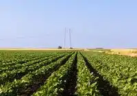

Climate change, biodiversity loss, and rapid urbanization are making the question of sustainable land use increasingly urgent. While modeling can enable informed decisions in policy and planning, its sheer number complicates its application. An EU-funded research project led by the Hamburg University of Applied Sciences (HAW Hamburg) has now developed a comprehensive database of modeling tools and freely accessible modeling maps to support sustainable land-use strategies across Europe.

The Europe-LAND project, led by Dr. Franziska Wolf, offers a systematic collection of tools for modeling land-use change (LUCC), providing insights into the impacts of human and natural influences on landscapes. These models are essential for analyzing land degradation, biodiversity, carbon balances, and environmental risks, and for shaping sustainable policy. The new database, the most comprehensive of its kind in Europe, categorizes tools by topics such as land cover, climate, hydrology, and biodiversity and describes their strengths, weaknesses, and application contexts. In addition, modular modeling maps provide a clear overview and concrete application examples, facilitating the selection and use of tools for researchers and planners.
The heterogeneity of LUCC models, for example due to different classifications or data limitations, has been a major hurdle to date. The new resources create transparency and enable the targeted selection of appropriate tools. This enables decision-makers to better understand complex landscape changes and develop data-driven, sustainable strategies. The maps and the database promote the accessibility and applicability of the models, which, according to the research team from Hamburg, Latvia, and Prague, makes land-use planning more effective for people, nature, and the climate.
Further information
also read
Innovative AI system can accurately map urban green spaces | Pugnalom
New robot helps with surveying in permafrost | Pugnalom